Wednesday, October 14, 2015

Typhoon KOPPU updates satellite images track forecast


October 15, 2015: It is likely to be hit Luzon on Saturday afternoon with 180-220 km/h winds according latest JTWC forecast


October 15, 2015: GFS rain forecast for Koppu.

October 15, 2015: Track forecast by weather.com

October 15, 2015: Latest track forecast and intensity tropical storm KOPPU 

October 15, 2015: Latest satellite image of tropical storm KOPPU. It will intensify into violent typhoon in next 48 hours.

Saturday, October 3, 2015

ECMWF MODEL PREDICTS BIG CYCLONE IN ARABIAN SEA SOON

ECMWF MODEL PREDICTS BIG CYCLONE IN ARABIAN SEA SOON this October

Latest data from the reliable European Model says a powerful tropical cyclone is imminent in the Arabian Sea in a few days.

According to it the storm will start off as a low near the Karnataka past on October 7, 2015. It will move north and intensify into a tropical cyclone.

According to the data available the storm is seen moving past Gujarat on October 13. With a central pressure of 981 Mb. Big storm.

The forecast is presently only supported by the less reliable NAVGEM model. A confirmation by the GFS would make us more confident.

Keep in touch for updates. We will give them as soon we receive them.

Wednesday, September 30, 2015

JOAQUIN: The 1st 2015 Hurricane Likely To Hit USA: Latest Updates


Update: September 30, 2015, 1030 hours GMT 

Joaquín intensifying and heading for Bahamas. It will soon become a hurricane and slowly moves towards central Bahamas. It will be hovering above central Bahamas on Friday. After that it will move back into the seas again. Conditions will become increasingly stormy on these islands. Friday will be worst.


Hurricane Joaquín Bahamas
Present satellite image shows tropical cyclone Joaquín close to Bahamas 


Update: September 30, 2015, 0730 hours GMT 

Tropical Storm Joaquín which is presently hovering near the Bahamas is likely to be the first hurricane to make landfall into mainland United States this year.

The system will intensify into a category 2 hurricane soon. Most forecast model expect it to hit the eastern coast on October 4, 2015. The states to be affected are Delaware, Maryland, Virginia and North Carolina.

The lone dissenter is the European ECMWF model that predicts Joaquín will become a 951 Mb monster by October 3 but it will not enter the US but swing back into the Atlantic.

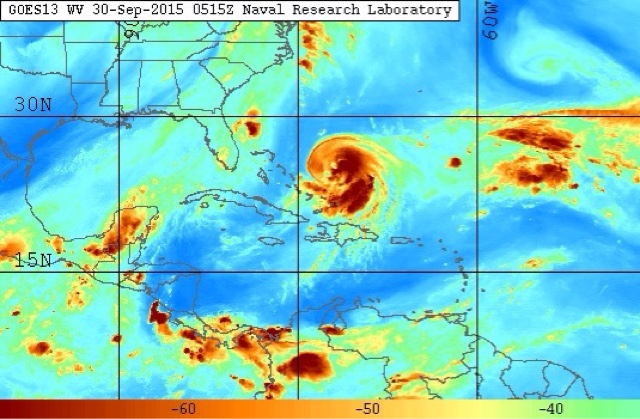
Hurricane Joaquín latest satellite water vapor image
Satellite water vapor image of Joaquín at 0515 GMT, September 30, 2015

Wednesday, September 23, 2015

Bay of Bengal may spawn a depression or cyclone by September 2015 end

Update 0700 GMT, September 24, 2015

Latest European model data says the expected low pressure area will develop near Little Andaman Island on September 29, 2015, that is on Tuesday. Initially it will move north then turn and make landfall into Andhra Pradesh on October 1, 2015. It will be a depression by then. It will move through Telangana and perhaps into either Madhya Pradesh or Vidarbha.

The system will be a big rainmaker so very heavy falls are expected in these states.

Update September 23, 2015

CYCLONE CHAPALA COMING IN BAY OF BENGAL SOON?

Forecast models are giving strong hints of a deep depression/tropical cyclone developing soon in the Bay of Bengal soon.

The expected system will start off as a low pressure area in the Andaman Sea on Monday, September 28, 2015. It will cross North Andaman Island, intensify iinto a deep depression or a cyclone and hit the Andhra coast near Visakhapatnam on October 2.

The threat is real as both tthe American and European models are supporting this scenario. The ECMWF expects a depression/low. The GFS is bullish on a deep depression/cyclone.

Latest ECMWF forecast says the expected Bay of Bengal storm is to be a depression. After Andhra it may head to Maharashtra, Gujarat. But too soon to say now.Keep in touch for updates.

This is where the storm will be born on Monday in the Andaman Sea.


Typhoon DUJUAN 2015 Latest Updates

Update: September 28, 2015, 0130 GMT 

The outer periphery of this category 4 hurricane is entering Taiwan. For the next 12 hours winds of 220 km/hr, gusts up to 260 km/h will lash the country.

Typhoon Dujuan will start weakening soon and will be a category 1 cyclone when it enters Fujian province of China tomorrow.


Typhoon Dujuan latest satellite image Taiwan September 2015
0030 GMT today satellite image shows Dujuan is entering Taiwan 

Update 0330 GMT, September 26, 2015

The typhoon is about 950 kilometres from the Taiwan coast. Dujuan will make direct hit on the northeast part of the country on September 29. It will pass through Taipei. It will be a category 4 cyclone with sustained winds of 230 km/ h.

On September 29 it will weaken and enter Fujian province of China. Fuzhou will be badly affected.

Latest track forecast typhoon Dujuan Taiwan Fujian China September 2015
Track forecast of Typhoon DUJUAN 


Update 0600 GMT, September 24, 2015

It is now almost certain that the target of typhoon Dujuan is China. The Fujian province just south of Shanghai. Though some forecast models say Shanghai itself may be where landfall may occur.

Time of impact is September 29, 2015. Before hitting China Dujuan will move dangerously close by the Taiwanese coast on Monday. Taipei will be affected.

Dujuan is already intensifying. Within the next 48 hours it will become a category 4 hurricane with winds in excess of 220 km/h. Though it is expected to weaken before nearing Taiwan.

It is presently about 1325 kilometres ESE of Taipei.

Latest track forecast typhoon Dujuan China Taiwan fujuan province Shanghai
Latest track forecast for typhoon Dujuan 


Updated 1330 GMT, September 23

Typhoon Dujuan: Where will it go?

There is wild disagreement presently. One computer model says it will slam into Kyushu, Japan.

Another says it will pass though northern Taiwan and then hit China coast below Shanghai on September 28, 2015.

_--------------------------
Even as Japan grapples with imminent threat from typhoon DUJUAN, there is bad news for countries in the Western Pacific Ocean. In the first week of October a low pressure area will slip in from the central Pacific which after entering west Pacific will intensify into a howling monster super typhoon called MUJIGAE.

We will monitor closely the possibility of the storm and then it's track once it forms. 

Bad news. DUJUAN is a baby compared to  MUJIGAE  if GFS forecasts are to be believed.

Below is a visualisation of the typhoon on October 8, 2015. Frightening.


==========================


Even as possibility of a Bay of Bengal storm threatening the Indian East coast increases, a typhoon called DUJUAN in the west Pacific Ocean is worrying Japanese authorities.

And they worry with a good reason. Typhoon DUJUAN is going to turn into a nasty category 4 hurricane and slam into Kyushu island in southern Japan on September 30, 2015. Though other forecast models say the cyclone will miss Japan and swing away harmlessly into northern Pacific.

Latest satellite image of tropical storm DUJUAN. It is already quite a powerful storm. The Pacific Ocean throws out some of the most powerful cyclones on earth. Much bigger than an average Indian Ocean or Atlantic Ocean hurricane.

Though the Japanese are used to them as they face them frequently, it does worry them. If a super cyclone makes a direct hit without weakening it can cause havoc. Typhoon Haiyan in 2013, hurricane Katrina in the US and the super cyclone of Orissa in 1999 are examples.


Friday, September 11, 2015

Arabian Sea Tropical Cyclone CHAPALA May Form On September 20, 2015

The Bay of Bengal is in ferment as a precursor to the birth of a depression on September 14, 2015. The storm system will form off the Andhra coast intensify and make landfall into Andhra on September 18. Very heavy rainfall is expected in Andhra and Telangana around September 18.

The rains will spread to norther Karnataka and Maharashtra as the depression moves through peninsular India and reach the Konkan coast on September 20. Mumbai or the coast just south of the city may face a deluge.

The depression will then move into the Arabian Sea and is expected to turn into tropical cyclone Chapala. The cyclone will kiss the Saurashtra coast and move south-west into the Arabian Sea. Present forecasts say it may hit the coast of southern Oman on September 24-25, 2015.

Chapala will be a 986 mb central minimum pressure cyclone by the 24th. Nothing to sneeze at.

Track forthcoming cyclone Chapala LIVE

cyclone chapala arabian sea september 2015
Cyclone Chapala as seen on September 24, 2015 heading for southern Oman.


Monday, September 7, 2015

Track Tropical Cyclone Chapala LIVE

UPDATE SEPTEMBER 16, 2015

Though the chances of cyclone Chapala forming are receding, the present Bay of Bengal depression is going to bring lots of rainfall in western India around September 20, 2015.
-------------------
Forecast models are hinting at a possible tropical cyclone CHAPALA in the North Indian Ocean by September 20, 2015.

Opinion differ amongst the GFS and ECMWF forecast models.

The GFS expects the cyclone to form in the Arabian Sea on September 19-20. The ECMWF predicts Chapala to form in the Bay of Bengal on September 16, 2015.

Track cyclone Chapala LIVE....


Friday, June 26, 2015

Monitor Australia And South Pacific Ocean LIVE


AUSTRALIA AND SOUTH PACIFIC OCEAN WINDS LIVE
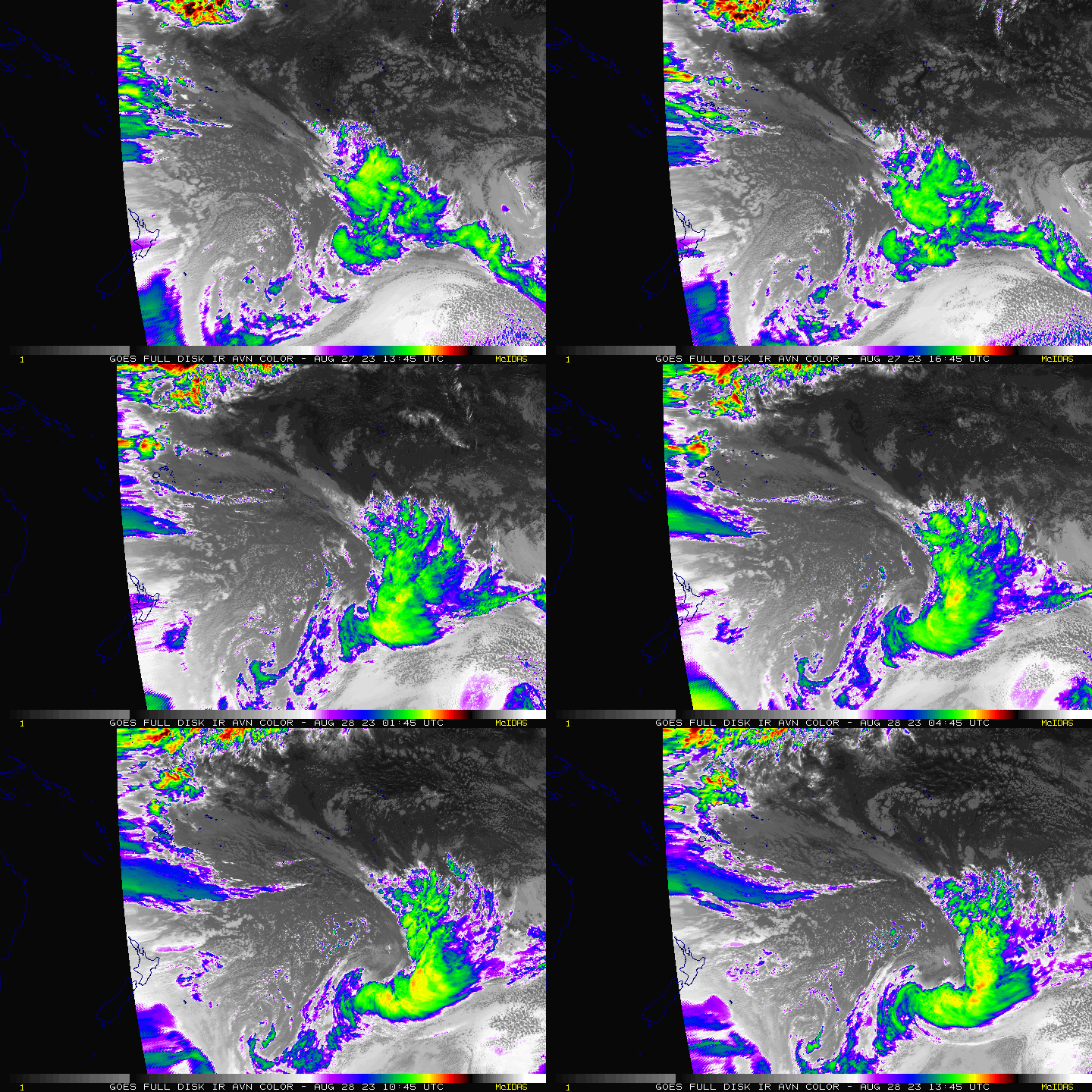
southern pacific latest satellite images
SOUTHERN PACIFIC LATEST SATELLITE IMAGES

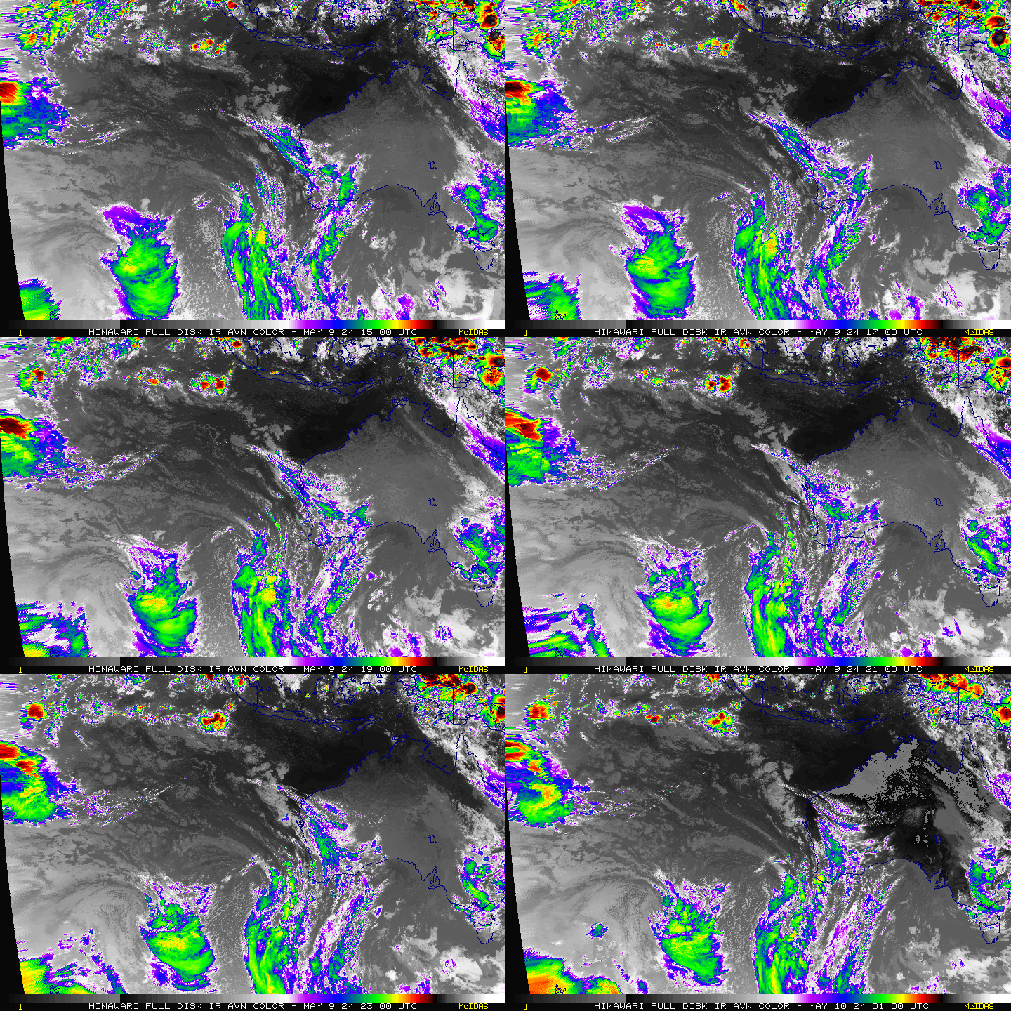
AUSTRALIA SOUTH EASTERN INDIAN OCEAN ANIMATED SATELLITE LATEST IMAGES
AUSTRALIA AND SOUTH EAST INDIAN OCEAN LATEST ANIMATED SATELLITE IMAGES

Monitor Southern Indian Ocean LIVE


SOUTHERN INDIAN OCEAN WIND SPEEDS

Monitor And See North Atlantic Ocean LIVE

NORTH ATLANTIC OCEAN AND UNITED STATES EASTERN SEA COAST WINDS LIVE MAP

MONITOR NORTH ATLANTIC OCEAN HURRICANE LIVE
LATEST NEAR REAL TIME SATELLITE IMAGES OF NORTH ATLANTIC OCEAN

Monitor Western Pacific Ocean LIVE

LIVE WIND SPEED MAP OF WESTERN PACIFIC. 

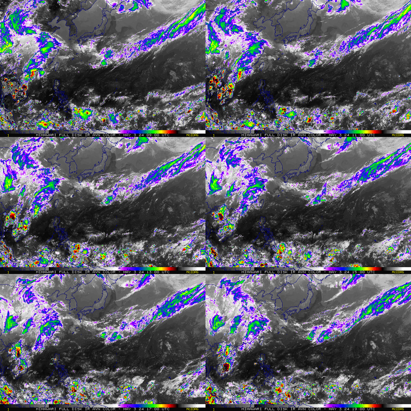
north west pacific ocean latest satellite images
LATEST NEAR REAL TIME SATELLITE IMAGES OF WESTERN PACIFIC OCEAN

Monitor North Indian Ocean (Arabian Sea, Bay Of Bengal) And South Asia LIVE


You can monitor North Indian Ocean (Bay of Bengal and Arabian Sea) and South Asia LIVE.

WIND SPEED MAP (LIVE) OF NORTH INDIAN OCEAN (ARABIAN SEA AND BAY OF BENGAL)


NORTH INDIAN OCEAN AND SOUTH ASIA RAINFALL MAP: WHERE IS IT RAINING NOW? WHITER THE PATCHES HEAVIER THE RAINFALL.